Got acreage in Pine or Bailey you want to showcase with clarity and impact? Drone photos can reveal views, access, and privacy in a way ground shots often miss. At the same time, you need to respect boundaries, neighbors, and local rules that protect public lands and wildlife. In this guide, you’ll learn what drone photos do best, how to stay on the right side of regulations, and the simple steps that keep everyone comfortable. Let’s dive in.
Why drone photos matter in Pine and Bailey
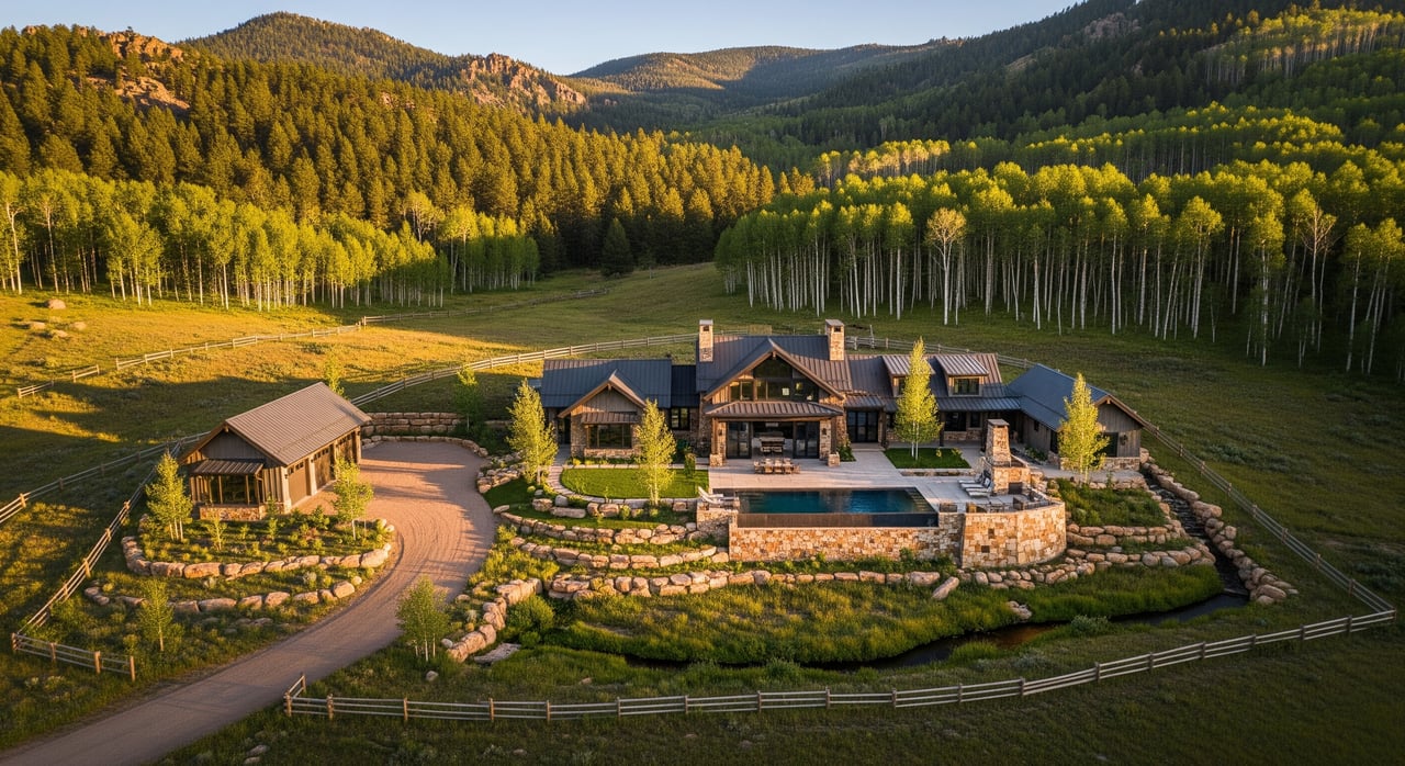
Drone imagery helps buyers understand the lay of the land at a glance. You can show view corridors, tree cover, pasture versus slope, and how the home sits within the acreage. You can also highlight proximity to public lands, trail access points, and major roads without leaving questions about context.
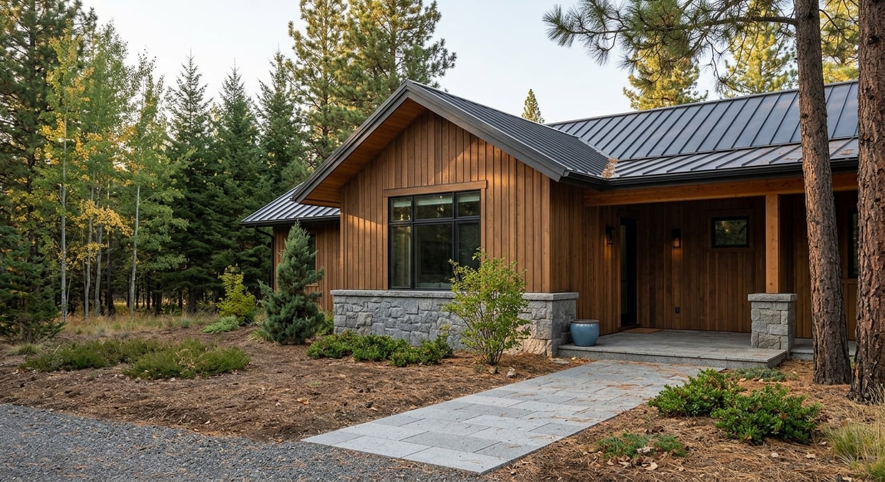
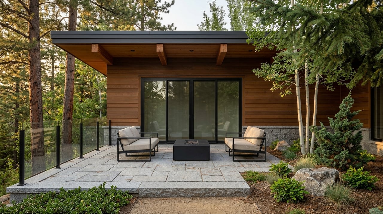
For sellers, strong aerials make your listing memorable and useful. Buyers can see the approach, parking, outbuildings, and improvements that matter for mountain living. Clear visuals also reduce wasted showings and help attract serious interest.
Showcase views, access, and improvements
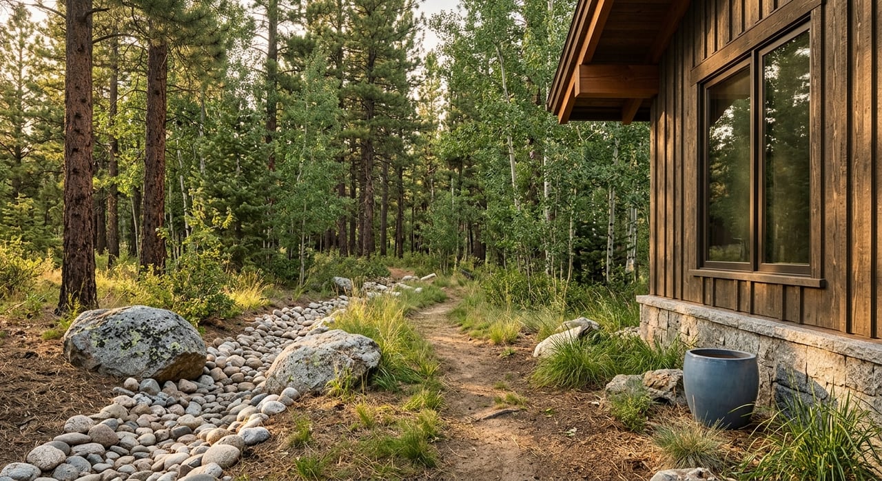
Focus on the approach, driveway layout, gates, and turnarounds. Capture barns, sheds, arenas, corrals, wells, solar arrays, and visible utility lines. Include a wide overview that situates the parcel next to Pike National Forest or county open space where relevant.
Spotlight privacy and setting
Use a mix of oblique and overhead shots to show screening from neighbors and any view exposure. Include sunrise or sunset angles to illustrate natural light. Note nearby roads or powerlines so buyers can balance views with potential noise.
Boundaries: what drones can and cannot show
Drone photos are excellent for illustrating visible features like fences, tree lines, creeks, ravines, and driveways. They help you communicate scale and setting quickly. However, drone images are not a legal survey and should be treated as illustrative.
Use imagery as illustration, not a survey
Legal property lines are set by deeds and verified by licensed surveys. While orthomosaics and measurements from imagery can be helpful estimates, they should carry accuracy disclaimers and not be used in contracts. For precision requirements, the FAA’s accuracy guidance underscores why imagery alone does not replace certified surveying work (survey accuracy overview).
When to hire a licensed surveyor
If you need confirmed boundaries for closing, easements, fencing, or subdividing, bring in a licensed Colorado land surveyor. Use the drone photos to start the conversation, then let the survey establish the official lines. This keeps your marketing informative and your documentation precise.
Privacy and neighbor etiquette in the foothills
Respect for neighbors goes a long way in mountain communities. Let adjacent owners know the timing and general plan if the camera could capture their homes or yards. Avoid filming people in private spaces and be ready to edit or blur images if requested.
Simple steps to respect privacy
- Get written consent from the property owner before flying.
- Notify nearby neighbors if they may appear in the frame; ask for permission when practical.
- Avoid filming through windows or into clearly private areas.
- Manage metadata and sharing so sensitive information is not exposed.
Colorado laws you should know
Colorado’s criminal invasion of privacy statute protects people where they have a reasonable expectation of privacy. Avoid capturing private activities or intimate areas without consent. You can review the statute here for context (Colorado Revised Statutes §18-7-801).
Know the rules before you fly
Local and federal rules work together in Pine and Bailey. Always verify FAA airspace and local land-manager policies before scheduling a shoot.
FAA basics for real estate marketing
For paid real estate work, use a Part 107-certified remote pilot and follow the Small UAS Rule, including visual line of sight and typical operations below 400 feet AGL (Part 107 overview). Check and obtain airspace authorization through LAANC when needed (LAANC info). Most registered drones must broadcast Remote ID (Remote ID guidance).
Pine and Bailey land managers
Jefferson County Open Space prohibits launching, landing, or operating drones from county open space without approval, so confirm whether your flight involves those lands (Jeffco regulations). In Park County, policies can vary by site, so check with county offices if the property borders public land or if you plan to operate near events or facilities (Park County Clerk & Recorder). The U.S. Forest Service allows drones in many areas but not in designated Wilderness Areas and never near wildfires or emergency aircraft (USFS UAS guidance). Colorado Parks & Wildlife also restricts drone use related to wildlife and hunting activities (CPW reminder via Vail Daily).
Shot list that sells acreage
- Overview hero: A high, wide oblique that frames the entire parcel and context.
- Perimeter sequence: Stills that show each side, fence lines, creeks, and tree belts.
- Approach and access: Driveway, gates, culverts, and parking/turnaround areas.
- Key assets: Home, barn, arenas, corrals, water features, solar, and visible utilities.
- Views and screening: View corridors and how vegetation or topography provides privacy.
- Scale cues: Include a vehicle or person for reference. Consider a labeled overlay as an illustration.
- Short video: A 30 to 90 second fly-through of the approach and top vantage points.
Mountain flight tips for better results
Plan shoots around golden hour for warmer light and texture. Use a mix of angled and straight-down shots to balance context with detail. In winter or at higher elevations around 6,700 to 8,000 feet, batteries drain faster and wind can be gusty, so plan shorter flights, keep batteries warm, and avoid strong gusts (DJI cold-weather tips).
Workflow and safety checklist
- Before the shoot: Verify pilot certification, registration, Remote ID, airspace approvals, and local park or open-space rules. Confirm landowner consent and check weather and winds.
- On site: Post a simple notice or let neighbors know. Keep visual line of sight, avoid flying over people or animals, and use a landing pad in wet or snowy areas.
- After the shoot: Share a brief flight summary with date, time, and location. Remove sensitive metadata if requested and store raw files according to the agreement.
Make it easy: have your agent coordinate
You do not have to manage the rules and shot planning on your own. A seasoned local agent can schedule a Part 107-certified, insured pilot, align the shot list with your marketing goals, and label imagery correctly so buyers get clarity without overstepping legal boundaries. If you are preparing to sell acreage in Pine or Bailey, we can help you plan a clean, compliant, and compelling shoot.
Ready to showcase your land the right way? Connect with Alicia Sexton for expert guidance and market-savvy marketing for mountain acreage.
FAQs
Are drone photos allowed for real estate listings in Pine and Bailey?
- Yes, when you follow FAA rules and local policies, such as using a Part 107-certified pilot, checking LAANC as needed, and respecting county open space and USFS rules (FAA Part 107, LAANC, Jeffco Open Space, USFS guidance).
Do drone photos prove my property boundaries for closing?
- No, drone images are illustrative only and do not replace a licensed survey, which is required for confirming legal boundaries and acreage in contracts (survey accuracy overview).
Do I need my neighbor’s permission for drone photos of my acreage?
- You should avoid filming people in private settings and it is best practice to notify neighbors and seek permission if the camera might capture their yards or homes, consistent with Colorado privacy protections (CRS §18-7-801).
How high can a drone fly for real estate photos near Pike National Forest?
- Most operations occur below 400 feet AGL under FAA rules, and you must maintain visual line of sight while also avoiding Wilderness Areas and fire or emergency operations (FAA basics, USFS UAS guidance).
What if my property borders Jefferson County Open Space or a state wildlife area?
- Launching or landing may be prohibited on those lands, so confirm where you take off and land and get permissions as required by the land manager (Jeffco Open Space regulations, CPW reminder).